


Compostelle 2 étapes Lelin Miramont Pomps

Nono55
User
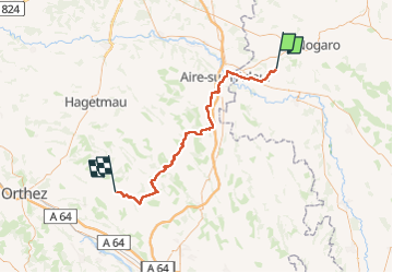

Length
78 km

Max alt
247 m

Uphill gradient
1050 m
Km-Effort
92 km

Min alt
78 m

Downhill gradient
1056 m
Boucle
No
Creation date :
2024-09-17 06:05:48.0
Updated on :
2024-09-18 16:35:13.33
15h17
Difficulty : Medium

FREE GPS app for hiking
 SityTrail
IGN / Geographical institutes
SityTrail Plus
The world is yours!
About
Trail Walking of 78 km to be discovered at Occitania, Gers, Lelin-Lapujolle. This trail is proposed by Nono55.
Description
Début d étape super chemin de sous bois très vallonné puis route route et route heureusement super paysage et beau village
Positioning
Country:
France
Region :
Occitania
Department/Province :
Gers
Municipality :
Lelin-Lapujolle
Location:
Unknown
Start:(Dec)
Start:(UTM)
730629 ; 4844141 (30T) N.
Comments