


Sob 10 cheverny Chémery

Glurps
User

Length
24 km

Max alt
124 m

Uphill gradient
178 m
Km-Effort
26 km

Min alt
86 m

Downhill gradient
185 m
Boucle
No
Creation date :
2024-09-19 07:00:09.0
Updated on :
2024-09-19 14:04:57.392

FREE GPS app for hiking
 SityTrail
IGN / Geographical institutes
SityTrail Plus
The world is yours!
About
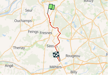
Trail of 24 km to be discovered at Centre-Loire Valley, Loir-et-Cher, Cheverny. This trail is proposed by Glurps.
Photos

Positioning
Country:
France
Region :
Centre-Loire Valley
Department/Province :
Loir-et-Cher
Municipality :
Cheverny
Location:
Unknown
Start:(Dec)
Start:(UTM)
380958 ; 5261200 (31T) N.
Comments