


ercepresliffre

ballay
User
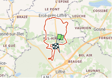

Length
13.4 km

Max alt
115 m

Uphill gradient
167 m
Km-Effort
15.6 km

Min alt
57 m

Downhill gradient
163 m
Boucle
No
Creation date :
2024-09-19 12:00:51.243
Updated on :
2024-09-19 15:25:48.176
3h22
Difficulty : Easy

FREE GPS app for hiking
 SityTrail
IGN / Geographical institutes
SityTrail Plus
The world is yours!
About
Trail Walking of 13.4 km to be discovered at Brittany, Ille-et-Vilaine, Liffré. This trail is proposed by ballay.
Positioning
Country:
France
Region :
Brittany
Department/Province :
Ille-et-Vilaine
Municipality :
Liffré
Location:
Unknown
Start:(Dec)
Start:(UTM)
610601 ; 5343481 (30U) N.
Comments