


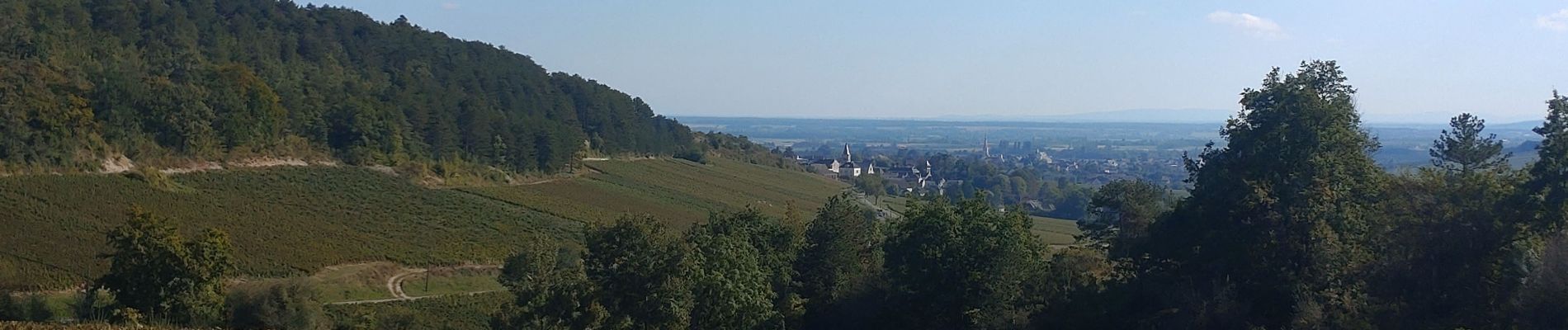
autour de MEURSAULT

okfred26
User
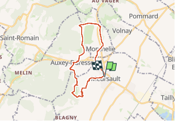

Length
12.9 km

Max alt
404 m

Uphill gradient
314 m
Km-Effort
17.1 km

Min alt
237 m

Downhill gradient
314 m
Boucle
Yes
Creation date :
2024-09-19 11:32:27.922
Updated on :
2024-09-19 15:38:43.955
4h06
Difficulty : Difficult

FREE GPS app for hiking
 SityTrail
IGN / Geographical institutes
SityTrail Plus
The world is yours!
About
Trail Walking of 12.9 km to be discovered at Bourgogne-Franche-Comté, Côte-d'Or, Meursault. This trail is proposed by okfred26.
Photos


Positioning
Country:
France
Region :
Bourgogne-Franche-Comté
Department/Province :
Côte-d'Or
Municipality :
Meursault
Location:
Unknown
Start:(Dec)
Start:(UTM)
634527 ; 5204380 (31T) N.
Comments