


adeps oignies 22/09/24

Luc Duc
User
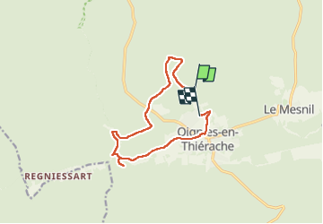

Length
10.7 km

Max alt
369 m

Uphill gradient
265 m
Km-Effort
14.2 km

Min alt
246 m

Downhill gradient
252 m
Boucle
No
Creation date :
2024-09-22 07:55:49.671
Updated on :
2024-09-22 10:41:21.595
2h32
Difficulty : Difficult

FREE GPS app for hiking
 SityTrail
IGN / Geographical institutes
SityTrail Plus
The world is yours!
About
Trail Walking of 10.7 km to be discovered at Wallonia, Namur, Viroinval. This trail is proposed by Luc Duc.
Positioning
Country:
Belgium
Region :
Wallonia
Department/Province :
Namur
Municipality :
Viroinval
Location:
Unknown
Start:(Dec)
Start:(UTM)
617057 ; 5543785 (31U) N.
Comments