


coldevence-pivoine

fab4u
User
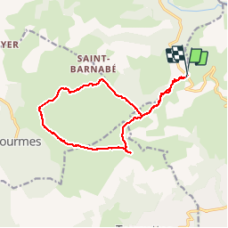

Length
15.7 km

Max alt
1263 m

Uphill gradient
434 m
Km-Effort
21 km

Min alt
937 m

Downhill gradient
432 m
Boucle
Yes
Creation date :
2015-05-13 00:00:00.0
Updated on :
2015-05-13 00:00:00.0
5h12
Difficulty : Unknown

FREE GPS app for hiking
 SityTrail
IGN / Geographical institutes
SityTrail Plus
The world is yours!
About
Trail Other activity of 15.7 km to be discovered at Provence-Alpes-Côte d'Azur, Maritime Alps, Vence. This trail is proposed by fab4u.


Positioning
Country:
France
Region :
Provence-Alpes-Côte d'Azur
Department/Province :
Maritime Alps
Municipality :
Vence
Location:
Unknown
Start:(Dec)
Start:(UTM)
344991 ; 4847069 (32T) N.
Comments
Très belle rando panoramique avec vues sur le littoral et sur le Mercantour dès le départ au col de Vence et quand on arrive au sommet. Stations de Pivoines à admirer et à protéger (ne jamais les cueillir !)