


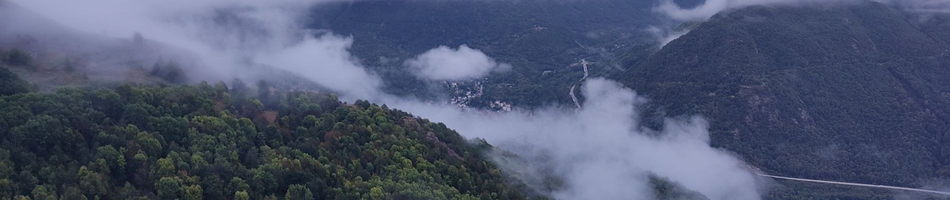
Le signal du Chioula

c.chehere
User
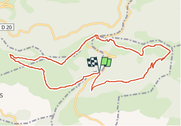

Length
13.1 km

Max alt
1620 m

Uphill gradient
481 m
Km-Effort
19.5 km

Min alt
1212 m

Downhill gradient
475 m
Boucle
Yes
Creation date :
2024-09-27 05:44:57.652
Updated on :
2024-09-27 15:25:13.175
4h26
Difficulty : Very difficult

FREE GPS app for hiking
 SityTrail
IGN / Geographical institutes
SityTrail Plus
The world is yours!
About
Trail Walking of 13.1 km to be discovered at Occitania, Ariège, Ignaux. This trail is proposed by c.chehere.
Photos


Positioning
Country:
France
Region :
Occitania
Department/Province :
Ariège
Municipality :
Ignaux
Location:
Unknown
Start:(Dec)
Start:(UTM)
405232 ; 4733377 (31T) N.
Comments