


plan d'aups ste baume

Michel DUBOIS
User
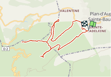

Length
12.7 km

Max alt
914 m

Uphill gradient
475 m
Km-Effort
19 km

Min alt
661 m

Downhill gradient
476 m
Boucle
Yes
Creation date :
2024-10-01 07:01:42.18
Updated on :
2024-10-01 13:34:53.253
3h43
Difficulty : Medium

FREE GPS app for hiking
 SityTrail
IGN / Geographical institutes
SityTrail Plus
The world is yours!
About
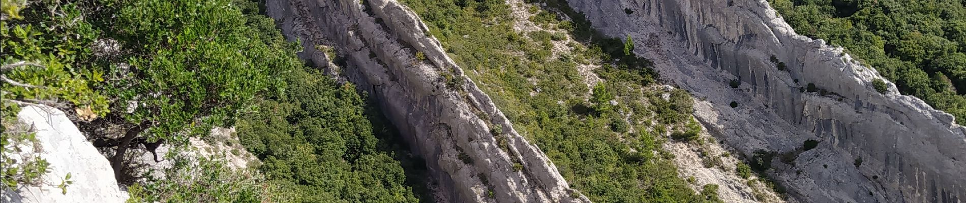
Trail Walking of 12.7 km to be discovered at Provence-Alpes-Côte d'Azur, Var, Plan-d'Aups-Sainte-Baume. This trail is proposed by Michel DUBOIS.
Photos


Positioning
Country:
France
Region :
Provence-Alpes-Côte d'Azur
Department/Province :
Var
Municipality :
Plan-d'Aups-Sainte-Baume
Location:
Unknown
Start:(Dec)
Start:(UTM)
719456 ; 4800300 (31T) N.
Comments