


Aulus - Erce - La Pastorale

pierre.chaudat
User
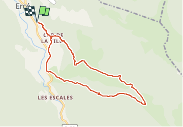

Length
9.9 km

Max alt
1030 m

Uphill gradient
424 m
Km-Effort
15.6 km

Min alt
630 m

Downhill gradient
424 m
Boucle
Yes
Creation date :
2024-10-01 09:20:43.0
Updated on :
2024-10-11 16:02:36.753
3h32
Difficulty : Medium

FREE GPS app for hiking
 SityTrail
IGN / Geographical institutes
SityTrail Plus
The world is yours!
About
Trail Walking of 9.9 km to be discovered at Occitania, Ariège, Ercé. This trail is proposed by pierre.chaudat.
Positioning
Country:
France
Region :
Occitania
Department/Province :
Ariège
Municipality :
Ercé
Location:
Unknown
Start:(Dec)
Start:(UTM)
360545 ; 4745036 (31T) N.
Comments