


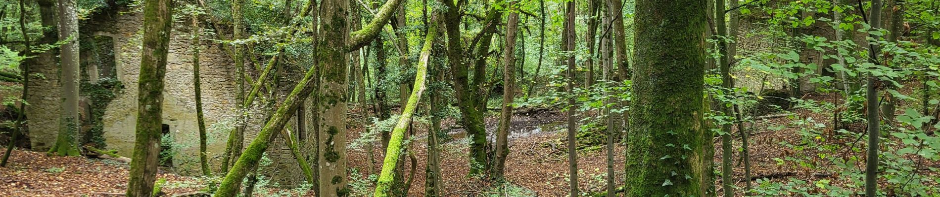
Le chemin des mines

noelphil
User
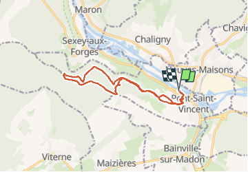

Length
13 km

Max alt
372 m

Uphill gradient
271 m
Km-Effort
16.6 km

Min alt
214 m

Downhill gradient
271 m
Boucle
Yes
Creation date :
2024-10-01 11:50:03.487
Updated on :
2024-10-01 15:30:23.772
3h39
Difficulty : Difficult

FREE GPS app for hiking
 SityTrail
IGN / Geographical institutes
SityTrail Plus
The world is yours!
About
Trail Walking of 13 km to be discovered at Grand Est, Meurthe-et-Moselle, Pont-Saint-Vincent. This trail is proposed by noelphil.
Photos


Positioning
Country:
France
Region :
Grand Est
Department/Province :
Meurthe-et-Moselle
Municipality :
Pont-Saint-Vincent
Location:
Unknown
Start:(Dec)
Start:(UTM)
285755 ; 5388016 (32U) N.
Comments