


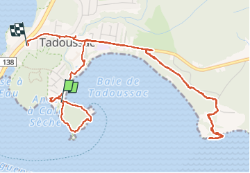
Tadoussac 8km

jeanmarcMasson
User GUIDE

Length
7.2 km

Max alt
72 m

Uphill gradient
159 m
Km-Effort
9.2 km

Min alt
2 m

Downhill gradient
137 m
Boucle
No
Creation date :
2024-10-03 19:19:54.883
Updated on :
2024-10-03 22:44:57.399
2h09
Difficulty : Medium

FREE GPS app for hiking
 SityTrail
IGN / Geographical institutes
SityTrail Plus
The world is yours!
About
Trail Walking of 7.2 km to be discovered at Quebec, La Haute-Côte-Nord, Tadoussac. This trail is proposed by jeanmarcMasson.
Positioning
Country:
Canada
Region :
Quebec
Department/Province :
La Haute-Côte-Nord
Municipality :
Tadoussac
Location:
Unknown
Start:(Dec)
Start:(UTM)
446571 ; 5331936 (19U) N.
Comments