


Sob 22 chamborand saint goussaud

Glurps
User
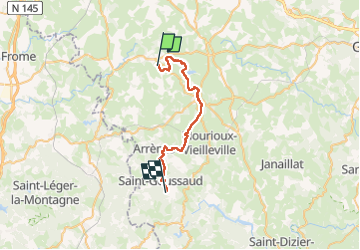

Length
29 km

Max alt
673 m

Uphill gradient
794 m
Km-Effort
39 km

Min alt
380 m

Downhill gradient
639 m
Boucle
No
Creation date :
2024-10-04 06:38:42.0
Updated on :
2024-10-04 18:57:26.69

FREE GPS app for hiking
 SityTrail
IGN / Geographical institutes
SityTrail Plus
The world is yours!
About
Trail of 29 km to be discovered at New Aquitaine, Creuse, Chamborand. This trail is proposed by Glurps.
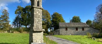
Photos


Positioning
Country:
France
Region :
New Aquitaine
Department/Province :
Creuse
Municipality :
Chamborand
Location:
Unknown
Start:(Dec)
Start:(UTM)
389833 ; 5111792 (31T) N.
Comments