


Sob peyrat le château - Lacelle

Glurps
User
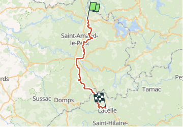

Length
32 km

Max alt
722 m

Uphill gradient
921 m
Km-Effort
44 km

Min alt
402 m

Downhill gradient
706 m
Boucle
No
Creation date :
2024-10-07 06:08:54.0
Updated on :
2024-10-07 16:31:20.224

FREE GPS app for hiking
 SityTrail
IGN / Geographical institutes
SityTrail Plus
The world is yours!
About
Trail of 32 km to be discovered at New Aquitaine, Haute-Vienne, Peyrat-le-Château. This trail is proposed by Glurps.
Photos


Positioning
Country:
France
Region :
New Aquitaine
Department/Province :
Haute-Vienne
Municipality :
Peyrat-le-Château
Location:
Unknown
Start:(Dec)
Start:(UTM)
404681 ; 5074286 (31T) N.
Comments