


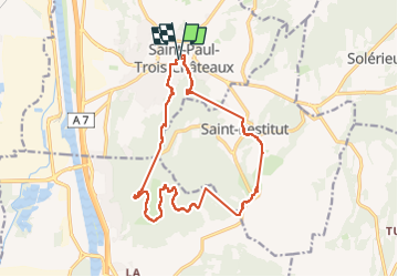
saint Paul les 3 chateaux

raygautier
User

Length
17.2 km

Max alt
299 m

Uphill gradient
621 m
Km-Effort
26 km

Min alt
90 m

Downhill gradient
621 m
Boucle
Yes
Creation date :
2024-10-06 07:48:12.368
Updated on :
2024-10-09 13:08:45.737
6h49
Difficulty : Very difficult

FREE GPS app for hiking
 SityTrail
IGN / Geographical institutes
SityTrail Plus
The world is yours!
About
Trail Walking of 17.2 km to be discovered at Auvergne-Rhône-Alpes, Drôme, Saint-Paul-Trois-Châteaux. This trail is proposed by raygautier.
Positioning
Country:
France
Region :
Auvergne-Rhône-Alpes
Department/Province :
Drôme
Municipality :
Saint-Paul-Trois-Châteaux
Location:
Unknown
Start:(Dec)
Start:(UTM)
641046 ; 4911952 (31T) N.
Comments