


Thorrenc

alinetpierre
User
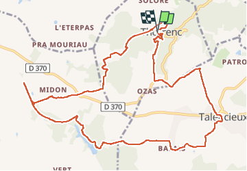

Length
14.5 km

Max alt
398 m

Uphill gradient
328 m
Km-Effort
18.8 km

Min alt
238 m

Downhill gradient
331 m
Boucle
Yes
Creation date :
2024-10-09 08:50:45.0
Updated on :
2024-10-09 13:18:17.859

FREE GPS app for hiking
 SityTrail
IGN / Geographical institutes
SityTrail Plus
The world is yours!
About
Trail of 14.5 km to be discovered at Auvergne-Rhône-Alpes, Ardèche, Thorrenc. This trail is proposed by alinetpierre.
Description
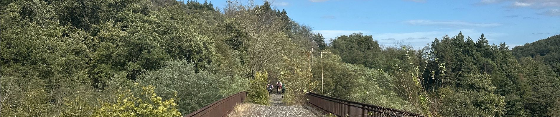
Thorrenc et le lac vert par Talencieux pour Azur
Photos


Positioning
Country:
France
Region :
Auvergne-Rhône-Alpes
Department/Province :
Ardèche
Municipality :
Thorrenc
Location:
Unknown
Start:(Dec)
Start:(UTM)
638281 ; 5010717 (31T) N.
Comments