


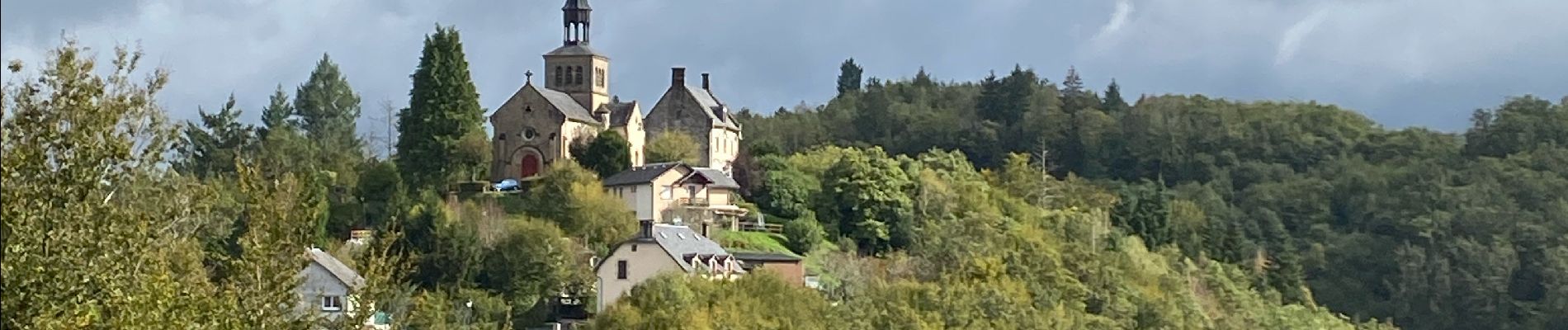
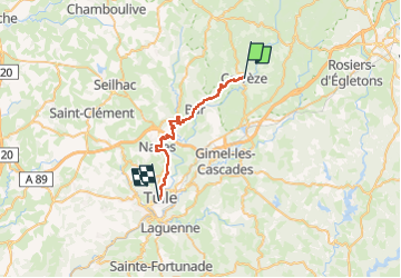
Sob Corrèze tulle

Glurps
User

Length
27 km

Max alt
555 m

Uphill gradient
549 m
Km-Effort
35 km

Min alt
213 m

Downhill gradient
811 m
Boucle
No
Creation date :
2024-10-10 07:11:48.0
Updated on :
2024-10-10 15:28:22.622

FREE GPS app for hiking
 SityTrail
IGN / Geographical institutes
SityTrail Plus
The world is yours!
About
Trail of 27 km to be discovered at New Aquitaine, Corrèze, Corrèze. This trail is proposed by Glurps.
Photos


Positioning
Country:
France
Region :
New Aquitaine
Department/Province :
Corrèze
Municipality :
Corrèze
Location:
Unknown
Start:(Dec)
Start:(UTM)
411824 ; 5024888 (31T) N.
Comments