


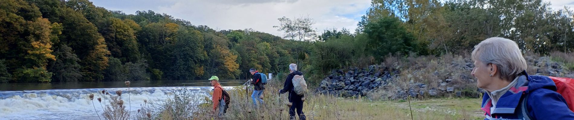
flavigny tonnoy

ISAGIL
User
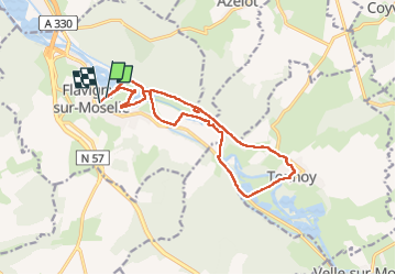

Length
14.3 km

Max alt
251 m

Uphill gradient
98 m
Km-Effort
15.6 km

Min alt
223 m

Downhill gradient
100 m
Boucle
Yes
Creation date :
2024-10-10 11:46:00.746
Updated on :
2024-10-10 15:52:09.766
3h07
Difficulty : Difficult

FREE GPS app for hiking
 SityTrail
IGN / Geographical institutes
SityTrail Plus
The world is yours!
About
Trail Walking of 14.3 km to be discovered at Grand Est, Meurthe-et-Moselle, Flavigny-sur-Moselle. This trail is proposed by ISAGIL.
Description
flavigny tonnoy
Photos


Positioning
Country:
France
Region :
Grand Est
Department/Province :
Meurthe-et-Moselle
Municipality :
Flavigny-sur-Moselle
Location:
Unknown
Start:(Dec)
Start:(UTM)
292863 ; 5383215 (32U) N.
Comments