


J6 Piton de la Fournaise

PhilippeC54
User
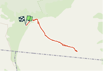

Length
9.9 km

Max alt
2517 m

Uphill gradient
445 m
Km-Effort
15.9 km

Min alt
2213 m

Downhill gradient
444 m
Boucle
Yes
Creation date :
2024-10-11 04:47:52.437
Updated on :
2024-10-11 12:15:32.915
3h24
Difficulty : Difficult

FREE GPS app for hiking
 SityTrail
IGN / Geographical institutes
SityTrail Plus
The world is yours!
About
Trail Walking of 9.9 km to be discovered at Réunion, Unknown, Sainte-Rose. This trail is proposed by PhilippeC54.
Positioning
Country:
France
Region :
Réunion
Department/Province :
Unknown
Municipality :
Sainte-Rose
Location:
Unknown
Start:(Dec)
Start:(UTM)
363497 ; 7652390 (40K) S.
Comments