


Pointe de la Mottaz

Jean-Paulchoux
User
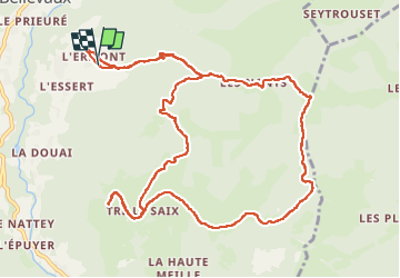

Length
13.2 km

Max alt
1630 m

Uphill gradient
767 m
Km-Effort
23 km

Min alt
1025 m

Downhill gradient
764 m
Boucle
Yes
Creation date :
2024-10-13 08:30:38.189
Updated on :
2024-10-13 14:20:36.818
3h58
Difficulty : Medium

FREE GPS app for hiking
 SityTrail
IGN / Geographical institutes
SityTrail Plus
The world is yours!
About
Trail Walking of 13.2 km to be discovered at Auvergne-Rhône-Alpes, Upper Savoy, Bellevaux. This trail is proposed by Jean-Paulchoux.
Positioning
Country:
France
Region :
Auvergne-Rhône-Alpes
Department/Province :
Upper Savoy
Municipality :
Bellevaux
Location:
Unknown
Start:(Dec)
Start:(UTM)
310505 ; 5124787 (32T) N.
Comments