Trail  Aubazines - Sob Aubazine  colonges  - Photo

Sob Aubazine colonges

 Glurps
Glurps

User

© OpenStreetMap contributors
Length
Length
27 km
Max alt
Max alt
516 m
Uphill gradient
Uphill gradient
676 m
Km-Effort
Km-Effort  
36 km
Min alt
Min alt
187 m
Downhill gradient
Downhill gradient
957 m
Boucle
Boucle
No
Creation date :
2024-10-13 06:24:51.0
Updated on :
2024-10-13 16:43:09.485

(0 Reviews)


Scan this QR Code to open this trail in the SityTrail application

FREE GPS app for hiking

Logo SityTrail SityTrail

IGN / Geographical institutes

Download SityTrail from the App Store Download SityTrail from Google Play

Logo SityTrail SityTrail Plus

The world is yours!

Download SityTrail from the App Store Download SityTrail from Google Play Download SityTrail on Huawei AppGallery

About

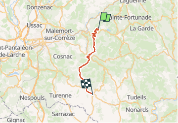
Trail of 27 km to be discovered at New Aquitaine, Corrèze, Aubazines. This trail is proposed by Glurps.
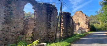
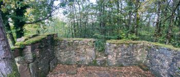
Elevation profile

Photos

Points of interest

Point of interest Aubazines - Monastère ruiné  - Photo
Glurps
Point of interest Aubazines - Calvaire - Photo
Glurps
AUBAZINES 
Point of interest Aubazines - Ancien village  - Photo
Glurps
AUBAZINES 

Positioning

Country:
France
Region :
New Aquitaine
Department/Province :
Corrèze
Municipality :
Aubazines
Location:
Unknown
Start:(UTM)
396899 ; 5004413 (31T) N.


Close
My subscriptions