


Rochehaut 051024

guyernage25
User
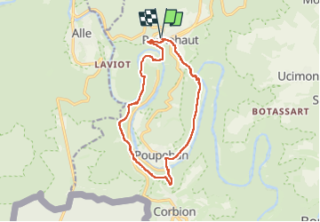

Length
13.4 km

Max alt
379 m

Uphill gradient
453 m
Km-Effort
19.4 km

Min alt
192 m

Downhill gradient
454 m
Boucle
Yes
Creation date :
2024-10-05 08:08:44.761
Updated on :
2024-10-14 11:36:48.049
4h13
Difficulty : Difficult

FREE GPS app for hiking
 SityTrail
IGN / Geographical institutes
SityTrail Plus
The world is yours!
About
Trail Walking of 13.4 km to be discovered at Wallonia, Luxembourg, Bouillon. This trail is proposed by guyernage25.
Description
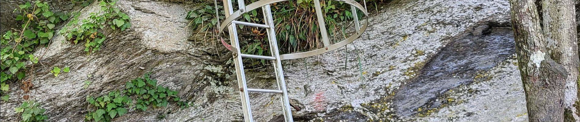
belle rando dans la vallée de la Semois via kes echelles
Photos


26 photos in total. Please click on a photo to see them all in the gallery.
Positioning
Country:
Belgium
Region :
Wallonia
Department/Province :
Luxembourg
Municipality :
Bouillon
Location:
Unknown
Start:(Dec)
Start:(UTM)
644047 ; 5522887 (31U) N.
Comments