


Col de château Julien

alinetpierre
User
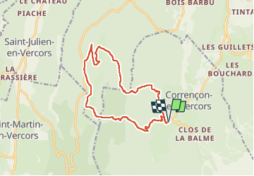

Length
15.6 km

Max alt
1554 m

Uphill gradient
656 m
Km-Effort
24 km

Min alt
1144 m

Downhill gradient
652 m
Boucle
Yes
Creation date :
2024-10-20 07:25:36.0
Updated on :
2024-10-20 14:23:21.62

FREE GPS app for hiking
 SityTrail
IGN / Geographical institutes
SityTrail Plus
The world is yours!
About
Trail of 15.6 km to be discovered at Auvergne-Rhône-Alpes, Isère, Corrençon-en-Vercors. This trail is proposed by alinetpierre.
Description
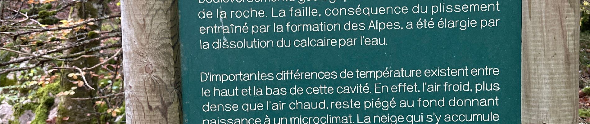
Superbe rando Azur
Photos


Positioning
Country:
France
Region :
Auvergne-Rhône-Alpes
Department/Province :
Isère
Municipality :
Corrençon-en-Vercors
Location:
Unknown
Start:(Dec)
Start:(UTM)
698331 ; 4988742 (31T) N.
Comments