


raucourt

Claude Luchetta
User

Length
25 km

Max alt
322 m

Uphill gradient
567 m
Km-Effort
33 km

Min alt
151 m

Downhill gradient
601 m
Boucle
No
Creation date :
2024-10-22 06:58:57.533
Updated on :
2024-10-22 10:02:04.995
3h02
Difficulty : Easy

FREE GPS app for hiking
 SityTrail
IGN / Geographical institutes
SityTrail Plus
The world is yours!
About
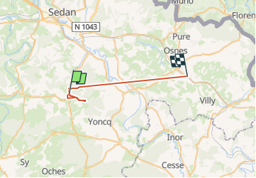
Trail Walking of 25 km to be discovered at Grand Est, Ardennes, Raucourt-et-Flaba. This trail is proposed by Claude Luchetta.
Positioning
Country:
France
Region :
Grand Est
Department/Province :
Ardennes
Municipality :
Raucourt-et-Flaba
Location:
Unknown
Start:(Dec)
Start:(UTM)
641469 ; 5496163 (31U) N.
Comments