


ullat - san-cristau / retour par la piste

stef789
User GUIDE
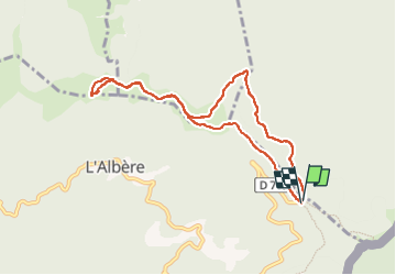

Length
9.1 km

Max alt
1020 m

Uphill gradient
323 m
Km-Effort
13.4 km

Min alt
872 m

Downhill gradient
327 m
Boucle
Yes
Creation date :
2024-10-23 10:13:38.926
Updated on :
2024-10-23 14:27:04.479
4h12
Difficulty : Easy

FREE GPS app for hiking
 SityTrail
IGN / Geographical institutes
SityTrail Plus
The world is yours!
About
Trail Walking of 9.1 km to be discovered at Occitania, Pyrénées-Orientales, L'Albère. This trail is proposed by stef789.
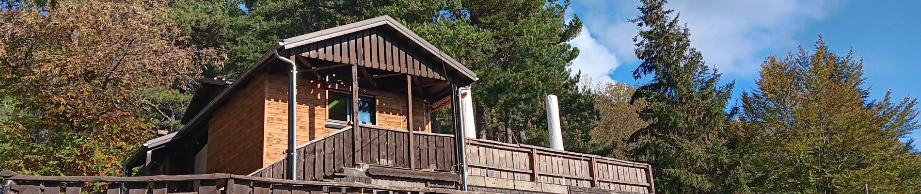
Photos


25 photos in total. Please click on a photo to see them all in the gallery.
Positioning
Country:
France
Region :
Occitania
Department/Province :
Pyrénées-Orientales
Municipality :
L'Albère
Location:
Unknown
Start:(Dec)
Start:(UTM)
493650 ; 4703008 (31T) N.
Comments