


ninglinspo

Benoît Servotte
User
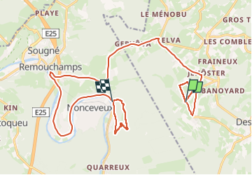

Length
19.6 km

Max alt
419 m

Uphill gradient
265 m
Km-Effort
24 km

Min alt
132 m

Downhill gradient
526 m
Boucle
No
Creation date :
2024-10-27 15:19:01.082
Updated on :
2024-10-27 16:43:50.38
1h24
Difficulty : Difficult

FREE GPS app for hiking
 SityTrail
IGN / Geographical institutes
SityTrail Plus
The world is yours!
About
Trail Walking of 19.6 km to be discovered at Wallonia, Liège, Theux. This trail is proposed by Benoît Servotte.
Positioning
Country:
Belgium
Region :
Wallonia
Department/Province :
Liège
Municipality :
Theux
Location:
La Reid
Start:(Dec)
Start:(UTM)
697212 ; 5594407 (31U) N.
Comments