


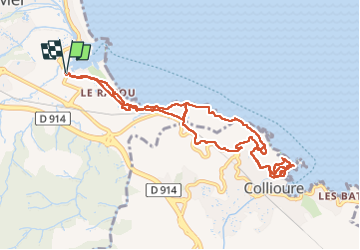
Argelès Collioure par la côte

rigol05
User

Length
12.3 km

Max alt
66 m

Uphill gradient
229 m
Km-Effort
15.3 km

Min alt
0 m

Downhill gradient
229 m
Boucle
Yes
Creation date :
2024-10-29 09:05:21.501
Updated on :
2024-11-19 15:42:35.736
3h28
Difficulty : Medium

FREE GPS app for hiking
 SityTrail
IGN / Geographical institutes
SityTrail Plus
The world is yours!
About
Trail Walking of 12.3 km to be discovered at Occitania, Pyrénées-Orientales, Argelès-sur-Mer. This trail is proposed by rigol05.
Description
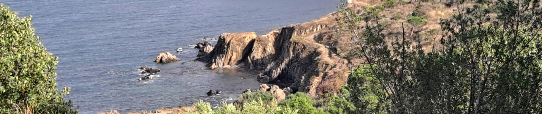
Sortie du 29/10/2024 Départ Port d'Argelès sur mer, sentier du littoral jusqu'a Collioure, visite du village. Cette période, beaucoup d'eau sur le sentier.
Photos


Positioning
Country:
France
Region :
Occitania
Department/Province :
Pyrénées-Orientales
Municipality :
Argelès-sur-Mer
Location:
Unknown
Start:(Dec)
Start:(UTM)
503906 ; 4709690 (31T) N.
Comments