


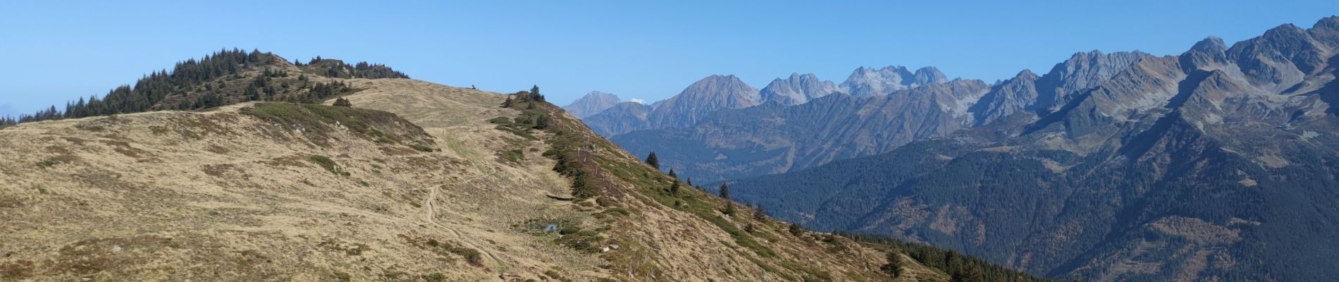
De Pipay au Cul de Pet en boucle - 30 oct 24

morganee
User

Length
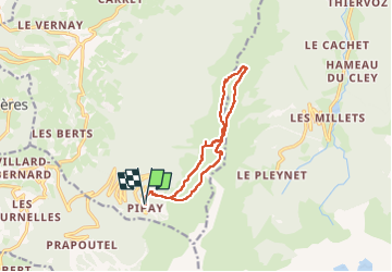
11.8 km

Max alt
1908 m

Uphill gradient
481 m
Km-Effort
18.2 km

Min alt
1570 m

Downhill gradient
482 m
Boucle
Yes
Creation date :
2024-10-30 09:24:13.316
Updated on :
2024-10-30 14:19:27.788
4h03
Difficulty : Easy

FREE GPS app for hiking
 SityTrail
IGN / Geographical institutes
SityTrail Plus
The world is yours!
About
Trail Walking of 11.8 km to be discovered at Auvergne-Rhône-Alpes, Isère, Theys. This trail is proposed by morganee.
Photos

Positioning
Country:
France
Region :
Auvergne-Rhône-Alpes
Department/Province :
Isère
Municipality :
Theys
Location:
Unknown
Start:(Dec)
Start:(UTM)
265878 ; 5016837 (32T) N.
Comments