


Balaruc

fario
User

Length
13.9 km

Max alt
36 m

Uphill gradient
127 m
Km-Effort
15.6 km

Min alt
-2 m

Downhill gradient
124 m
Boucle
No
Creation date :
2024-11-02 09:43:53.86
Updated on :
2024-11-02 10:07:46.029
22m
Difficulty : Difficult

FREE GPS app for hiking
 SityTrail
IGN / Geographical institutes
SityTrail Plus
The world is yours!
About
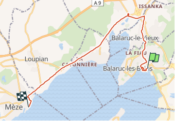
Trail Walking of 13.9 km to be discovered at Occitania, Hérault, Balaruc-les-Bains. This trail is proposed by fario.
Positioning
Country:
France
Region :
Occitania
Department/Province :
Hérault
Municipality :
Balaruc-les-Bains
Location:
Unknown
Start:(Dec)
Start:(UTM)
556119 ; 4810389 (31T) N.
Comments