


ouillon ouillon

mout38
User
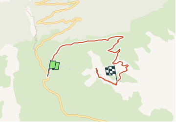

Length
7.4 km

Max alt
2638 m

Uphill gradient
628 m
Km-Effort
13.9 km

Min alt
2060 m

Downhill gradient
61 m
Boucle
No
Creation date :
2024-08-05 08:49:38.024
Updated on :
2024-11-03 09:05:28.901
1h31
Difficulty : Difficult

FREE GPS app for hiking
 SityTrail
IGN / Geographical institutes
SityTrail Plus
The world is yours!
About
Trail Walking of 7.4 km to be discovered at Auvergne-Rhône-Alpes, Savoy, Val-Cenis. This trail is proposed by mout38.
Description
ouillon
Positioning
Country:
France
Region :
Auvergne-Rhône-Alpes
Department/Province :
Savoy
Municipality :
Val-Cenis
Location:
Unknown
Start:(Dec)
Start:(UTM)
335352 ; 5014298 (32T) N.
Comments