


Lac vert et jumeaux

ja.13061965
User
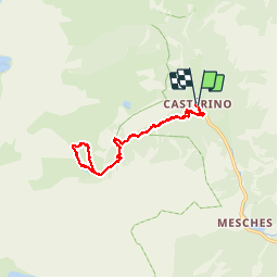

Length
13.7 km

Max alt
2238 m

Uphill gradient
695 m
Km-Effort
23 km

Min alt
1545 m

Downhill gradient
692 m
Boucle
Yes
Creation date :
2019-06-20 09:32:48.351
Updated on :
2019-06-20 09:32:49.156
6h04
Difficulty : Medium

FREE GPS app for hiking
 SityTrail
IGN / Geographical institutes
SityTrail Plus
The world is yours!
About
Trail Walking of 13.7 km to be discovered at Provence-Alpes-Côte d'Azur, Maritime Alps, Tende. This trail is proposed by ja.13061965.
Description
Très belle
Positioning
Country:
France
Region :
Provence-Alpes-Côte d'Azur
Department/Province :
Maritime Alps
Municipality :
Tende
Location:
Unknown
Start:(Dec)
Start:(UTM)
380452 ; 4883827 (32T) N.
Comments