


rupt; croix et beluet

GuySimonin
User
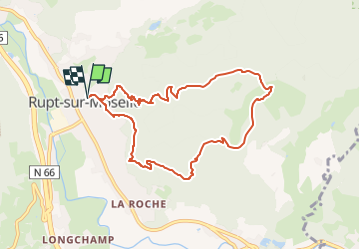

Length
8.2 km

Max alt
874 m

Uphill gradient
494 m
Km-Effort
14.8 km

Min alt
422 m

Downhill gradient
494 m
Boucle
Yes
Creation date :
2024-11-09 18:42:05.091
Updated on :
2024-11-09 18:42:56.282
3h22
Difficulty : Difficult

FREE GPS app for hiking
 SityTrail
IGN / Geographical institutes
SityTrail Plus
The world is yours!
About
Trail Walking of 8.2 km to be discovered at Grand Est, Vosges, Rupt-sur-Moselle. This trail is proposed by GuySimonin.
Positioning
Country:
France
Region :
Grand Est
Department/Province :
Vosges
Municipality :
Rupt-sur-Moselle
Location:
Unknown
Start:(Dec)
Start:(UTM)
325230 ; 5310895 (32T) N.
Comments