


ar chat

lbuteux
User
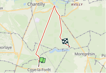

Length
10 km

Max alt
105 m

Uphill gradient
119 m
Km-Effort
11.5 km

Min alt
34 m

Downhill gradient
95 m
Boucle
No
Creation date :
2024-11-09 21:43:44.305
Updated on :
2024-11-09 21:43:47.179
1h00
Difficulty : Very easy

FREE GPS app for hiking
 SityTrail
IGN / Geographical institutes
SityTrail Plus
The world is yours!
About
Trail Trail of 10 km to be discovered at Hauts-de-France, Oise, Coye-la-Forêt. This trail is proposed by lbuteux.
Positioning
Country:
France
Region :
Hauts-de-France
Department/Province :
Oise
Municipality :
Coye-la-Forêt
Location:
Unknown
Start:(Dec)
Start:(UTM)
461105 ; 5443690 (31U) N.
Comments