Trail Other activity Eindhoven - 20100731010757 - Photo
© OpenStreetMap contributors
Length
Length
167 km
Max alt
Max alt
31 m
Uphill gradient
Uphill gradient
741 m
Km-Effort
Km-Effort  
177 km
Min alt
Min alt
2 m
Downhill gradient
Downhill gradient
741 m
Boucle
Boucle
Yes
Creation date :
2014-12-10 00:00:00.0
Updated on :
2014-12-10 00:00:00.0

(0 Reviews)

Other activity
Other activity
--
Difficulty : Unknown

Scan this QR Code to open this trail in the SityTrail application

FREE GPS app for hiking

Logo SityTrail SityTrail

IGN / Geographical institutes

Download SityTrail from the App Store Download SityTrail from Google Play

Logo SityTrail SityTrail Plus

The world is yours!

Download SityTrail from the App Store Download SityTrail from Google Play Download SityTrail on Huawei AppGallery

About

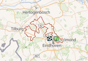
Trail Other activity of 167 km to be discovered at North Brabant, Unknown, Eindhoven. This trail is proposed by gerardheiner.

Elevation profile

Points of interest

Point of interest Eindhoven -  - Photo
gerardheiner
EINDHOVEN 
Point of interest Son en Breugel -  - Photo
gerardheiner
SON EN BREUGEL 
Point of interest Oirschot -  - Photo
gerardheiner
OIRSCHOT 
Point of interest Oirschot -  - Photo
gerardheiner
OIRSCHOT 
Point of interest Sint-Michielsgestel -  - Photo
gerardheiner
SINT-MICHIELSGESTEL 

Positioning

Country:
Netherlands
Region :
North Brabant
Department/Province :
Unknown
Municipality :
Eindhoven
Location:
Unknown
Start:(UTM)
673316 ; 5702604 (31U) N.


Close
My subscriptions