


col gli chal auges

COMAN
User
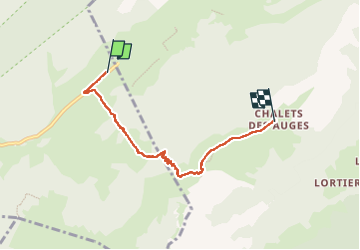

Length
6.4 km

Max alt
1796 m

Uphill gradient
389 m
Km-Effort
10.5 km

Min alt
1410 m

Downhill gradient
65 m
Boucle
No
Creation date :
2015-06-24 00:00:00.0
Updated on :
2015-06-24 00:00:00.0
4h00
Difficulty : Difficult

FREE GPS app for hiking
 SityTrail
IGN / Geographical institutes
SityTrail Plus
The world is yours!
About
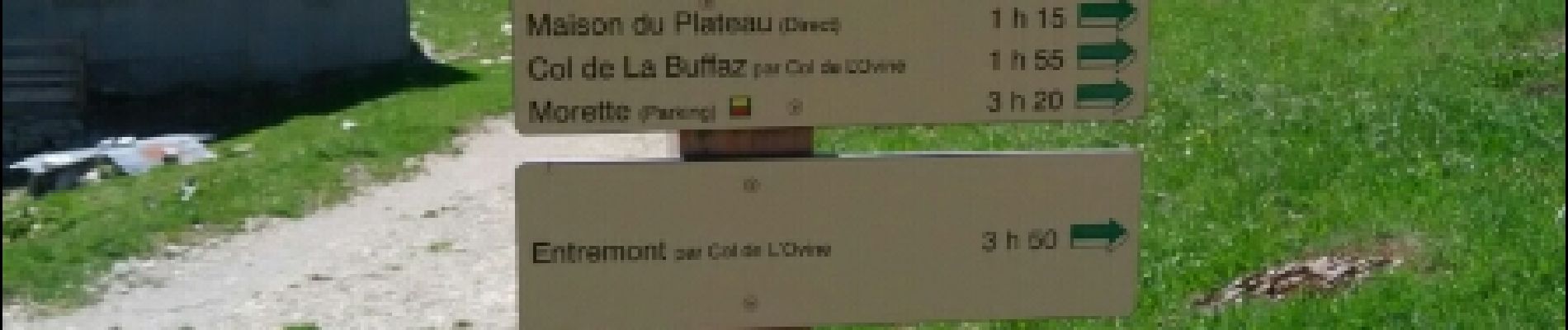
Trail Walking of 6.4 km to be discovered at Auvergne-Rhône-Alpes, Upper Savoy, Fillière. This trail is proposed by COMAN.
Description
collecte
Photos


53 photos in total. Please click on a photo to see them all in the gallery.


Positioning
Country:
France
Region :
Auvergne-Rhône-Alpes
Department/Province :
Upper Savoy
Municipality :
Fillière
Location:
Thorens-Glières
Start:(Dec)
Start:(UTM)
293153 ; 5093697 (32T) N.
Comments