


rando cool

rouky
User
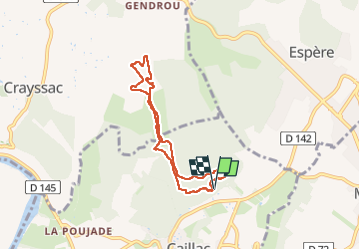

Length
6.6 km

Max alt
303 m

Uphill gradient
166 m
Km-Effort
8.8 km

Min alt
154 m

Downhill gradient
165 m
Boucle
Yes
Creation date :
2024-11-15 07:39:32.026
Updated on :
2024-11-15 09:10:40.083
1h30
Difficulty : Easy

FREE GPS app for hiking
 SityTrail
IGN / Geographical institutes
SityTrail Plus
The world is yours!
About
Trail Walking of 6.6 km to be discovered at Occitania, Lot, Caillac. This trail is proposed by rouky.

Positioning
Country:
France
Region :
Occitania
Department/Province :
Lot
Municipality :
Caillac
Location:
Unknown
Start:(Dec)
Start:(UTM)
369453 ; 4928392 (31T) N.
Comments