


Mazaye

Gegetop
User
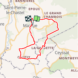

Length
14.5 km

Max alt
844 m

Uphill gradient
257 m
Km-Effort
18 km

Min alt
705 m

Downhill gradient
256 m
Boucle
Yes
Creation date :
2015-05-29 00:00:00.0
Updated on :
2015-05-29 00:00:00.0
3h29
Difficulty : Easy

FREE GPS app for hiking
 SityTrail
IGN / Geographical institutes
SityTrail Plus
The world is yours!
About
Trail Walking of 14.5 km to be discovered at Auvergne-Rhône-Alpes, Puy-de-Dôme, Mazaye. This trail is proposed by Gegetop.
Description
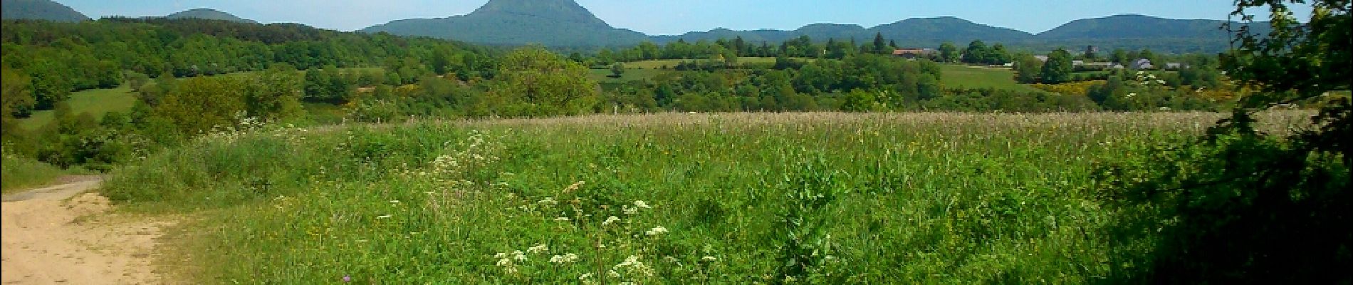
Petite randonnée très agréable à faire de préférence un jour de chaleur car la forêt omniprésente sur les deux tiers du parcours vous accueille avec fraîcheur.
Photos


Positioning
Country:
France
Region :
Auvergne-Rhône-Alpes
Department/Province :
Puy-de-Dôme
Municipality :
Mazaye
Location:
Unknown
Start:(Dec)
Start:(UTM)
489286 ; 5070290 (31T) N.
Comments