


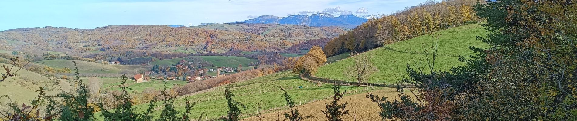
La table d'orientation à Chasselay marche

crocau
User
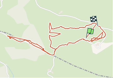

Length
3.9 km

Max alt
681 m

Uphill gradient
135 m
Km-Effort
5.8 km

Min alt
554 m

Downhill gradient
160 m
Boucle
Yes
Creation date :
2024-11-24 11:20:02.498
Updated on :
2024-11-24 13:01:50.135
1h20
Difficulty : Very easy

FREE GPS app for hiking
 SityTrail
IGN / Geographical institutes
SityTrail Plus
The world is yours!
About
Trail Walking of 3.9 km to be discovered at Auvergne-Rhône-Alpes, Isère, Chasselay. This trail is proposed by crocau.
Photos


Positioning
Country:
France
Region :
Auvergne-Rhône-Alpes
Department/Province :
Isère
Municipality :
Chasselay
Location:
Unknown
Start:(Dec)
Start:(UTM)
682915 ; 5013694 (31T) N.
Comments