


Moulin marquis

alinetpierre
User
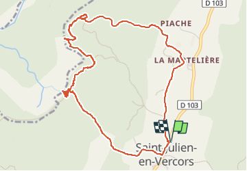

Length
5.9 km

Max alt
933 m

Uphill gradient
236 m
Km-Effort
9.1 km

Min alt
770 m

Downhill gradient
237 m
Boucle
Yes
Creation date :
2024-11-27 08:55:06.0
Updated on :
2024-11-27 11:14:53.539

FREE GPS app for hiking
 SityTrail
IGN / Geographical institutes
SityTrail Plus
The world is yours!
About
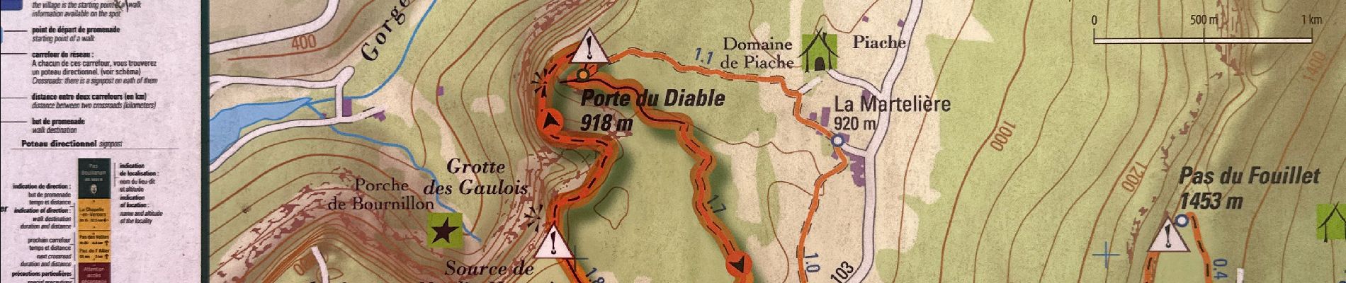
Trail of 5.9 km to be discovered at Auvergne-Rhône-Alpes, Drôme, Saint-Julien-en-Vercors. This trail is proposed by alinetpierre.
Description
Passages vertigineux
Photos


Positioning
Country:
France
Region :
Auvergne-Rhône-Alpes
Department/Province :
Drôme
Municipality :
Saint-Julien-en-Vercors
Location:
Unknown
Start:(Dec)
Start:(UTM)
692925 ; 4991567 (31T) N.
Comments