Trail Walking Montbron - La rando de la Tardoire à Montbron  - Photo

La rando de la Tardoire à Montbron

© OpenStreetMap contributors
Length
Length
6.5 km
Max alt
Max alt
168 m
Uphill gradient
Uphill gradient
92 m
Km-Effort
Km-Effort  
7.7 km
Min alt
Min alt
113 m
Downhill gradient
Downhill gradient
89 m
Boucle
Boucle
Yes
Creation date :
2024-11-28 12:53:09.066
Updated on :
2024-11-28 15:16:49.445

(0 Reviews)

Walking
Walking
2h23
Difficulty : Medium

Scan this QR Code to open this trail in the SityTrail application

FREE GPS app for hiking

Logo SityTrail SityTrail

IGN / Geographical institutes

Download SityTrail from the App Store Download SityTrail from Google Play

Logo SityTrail SityTrail Plus

The world is yours!

Download SityTrail from the App Store Download SityTrail from Google Play Download SityTrail on Huawei AppGallery

About

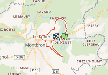
Trail Walking of 6.5 km to be discovered at New Aquitaine, Charente, Montbron. This trail is proposed by alainjoseph6.

Description

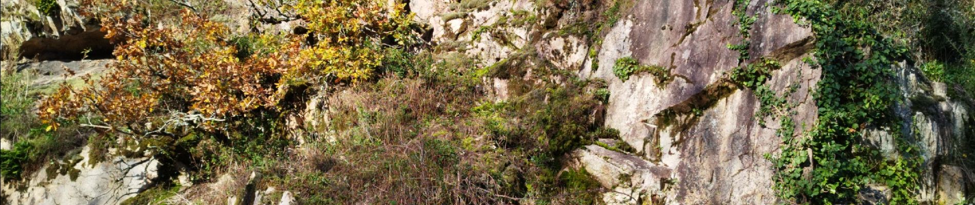
Au départ du château 🏰 de Menet avec son moulin en passant par Montbron et son église romane et retour par le château 🏰 de Chabro et le restaurant du moulin de la Tardoire et retour en passant devant la vallée de la Renaudie.

Elevation profile

Photos

Positioning

Country:
France
Region :
New Aquitaine
Department/Province :
Charente
Municipality :
Montbron
Location:
Unknown
Start:(UTM)
306342 ; 5060079 (31T) N.


Close
My subscriptions