


TALAMARCHE

Jean-Paulchoux
User
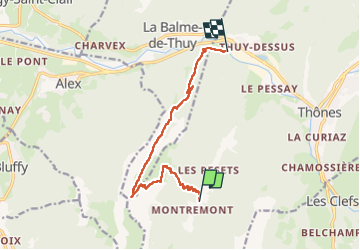

Length
10.4 km

Max alt
1737 m

Uphill gradient
951 m
Km-Effort
24 km

Min alt
604 m

Downhill gradient
1138 m
Boucle
No
Creation date :
2024-12-01 08:19:09.735
Updated on :
2024-12-01 14:44:22.836
3h54
Difficulty : Difficult

FREE GPS app for hiking
 SityTrail
IGN / Geographical institutes
SityTrail Plus
The world is yours!
About
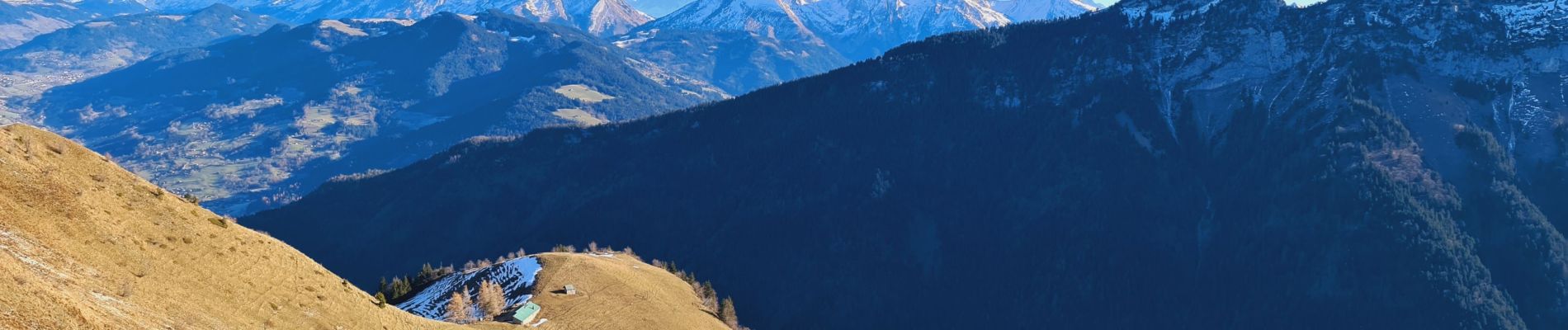
Trail Walking of 10.4 km to be discovered at Auvergne-Rhône-Alpes, Upper Savoy, Thônes. This trail is proposed by Jean-Paulchoux.
Photos

Positioning
Country:
France
Region :
Auvergne-Rhône-Alpes
Department/Province :
Upper Savoy
Municipality :
Thônes
Location:
Unknown
Start:(Dec)
Start:(UTM)
289052 ; 5082149 (32T) N.
Comments