


corbas 47 67

Julliengamo
User

Length
15.6 km

Max alt
227 m

Uphill gradient
112 m
Km-Effort
17.1 km

Min alt
183 m

Downhill gradient
130 m
Boucle
No
Creation date :
2024-12-02 05:22:08.561
Updated on :
2024-12-02 06:22:28.14
1h00
Difficulty : Very easy

FREE GPS app for hiking
 SityTrail
IGN / Geographical institutes
SityTrail Plus
The world is yours!
About
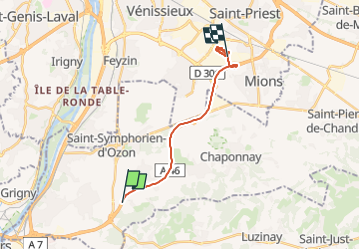
Trail Car of 15.6 km to be discovered at Auvergne-Rhône-Alpes, Rhône, Simandres. This trail is proposed by Julliengamo.
Description
ramasse corbas
Positioning
Country:
France
Region :
Auvergne-Rhône-Alpes
Department/Province :
Rhône
Municipality :
Simandres
Location:
Unknown
Start:(Dec)
Start:(UTM)
645023 ; 5051865 (31T) N.
Comments