


La route des etangs

jpfrobert
User
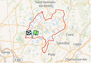

Length
73 km

Max alt
312 m

Uphill gradient
590 m
Km-Effort
81 km

Min alt
241 m

Downhill gradient
587 m
Boucle
Yes
Creation date :
2024-12-04 16:36:39.145
Updated on :
2024-12-04 16:37:34.376
4h00
Difficulty : Difficult

FREE GPS app for hiking
 SityTrail
IGN / Geographical institutes
SityTrail Plus
The world is yours!
About
Trail Electric bike of 73 km to be discovered at Auvergne-Rhône-Alpes, Ain, Saint-Marcel. This trail is proposed by jpfrobert.
Positioning
Country:
France
Region :
Auvergne-Rhône-Alpes
Department/Province :
Ain
Municipality :
Saint-Marcel
Location:
Unknown
Start:(Dec)
Start:(UTM)
653926 ; 5090270 (31T) N.
Comments