


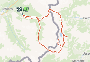
circuit de la Béssanèse

dansanet
User

Length
48 km

Max alt
3542 m

Uphill gradient
4021 m
Km-Effort
101 km

Min alt
1821 m

Downhill gradient
4020 m
Boucle
Yes
Creation date :
2024-12-09 08:47:12.84
Updated on :
2024-12-09 08:48:12.635
22h59
Difficulty : Very difficult

FREE GPS app for hiking
 SityTrail
IGN / Geographical institutes
SityTrail Plus
The world is yours!
About
Trail On foot of 48 km to be discovered at Auvergne-Rhône-Alpes, Savoy, Bessans. This trail is proposed by dansanet.
Points of interest


Positioning
Country:
France
Region :
Auvergne-Rhône-Alpes
Department/Province :
Savoy
Municipality :
Bessans
Location:
Unknown
Start:(Dec)
Start:(UTM)
346119 ; 5019084 (32T) N.
Comments