


chamois 10 12 24

tgvpatrickfavre
User

Length
7.7 km

Max alt
1005 m

Uphill gradient
343 m
Km-Effort
12.3 km

Min alt
661 m

Downhill gradient
343 m
Boucle
Yes
Creation date :
2024-12-10 13:07:44.122
Updated on :
2024-12-10 15:29:24.818
2h21
Difficulty : Medium

FREE GPS app for hiking
 SityTrail
IGN / Geographical institutes
SityTrail Plus
The world is yours!
About
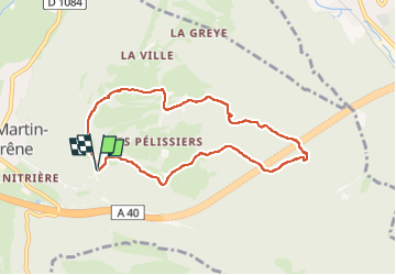
Trail Walking of 7.7 km to be discovered at Auvergne-Rhône-Alpes, Ain, Saint-Martin-du-Frêne. This trail is proposed by tgvpatrickfavre.
Description
tour sur chamois mais chemins abîmés par forestier
Positioning
Country:
France
Region :
Auvergne-Rhône-Alpes
Department/Province :
Ain
Municipality :
Saint-Martin-du-Frêne
Location:
Unknown
Start:(Dec)
Start:(UTM)
698267 ; 5111934 (31T) N.
Comments