


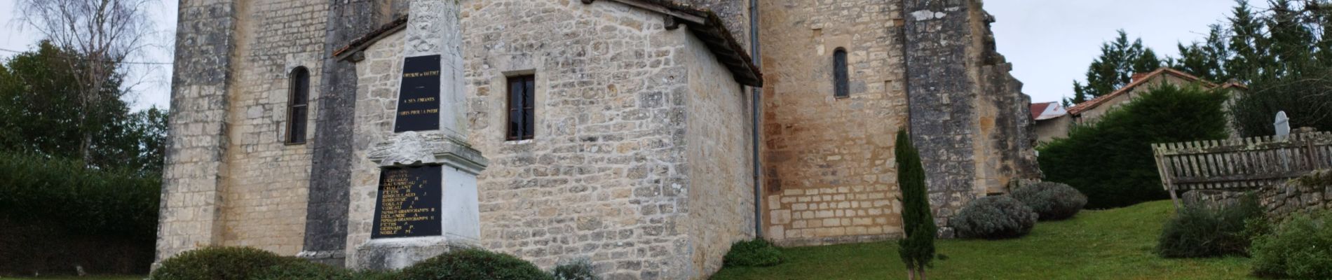
Valence en Charente

alainjoseph6
User
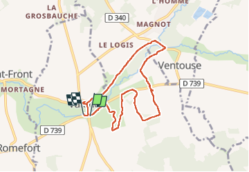

Length
7.8 km

Max alt
106 m

Uphill gradient
112 m
Km-Effort
9.3 km

Min alt
74 m

Downhill gradient
112 m
Boucle
Yes
Creation date :
2024-12-03 07:59:10.387
Updated on :
2024-12-12 10:51:16.573
2h48
Difficulty : Medium

FREE GPS app for hiking
 SityTrail
IGN / Geographical institutes
SityTrail Plus
The world is yours!
About
Trail Walking of 7.8 km to be discovered at New Aquitaine, Charente, Valence. This trail is proposed by alainjoseph6.
Description
Une belle balade au départ de Valence au bord de la rivière son-sonnette.
Son château 🏰 Bourgon et ses petits villages.
Nous cheminons autour de la vallée du Son et de la Sonnette.
Photos


Positioning
Country:
France
Region :
New Aquitaine
Department/Province :
Charente
Municipality :
Valence
Location:
Unknown
Start:(Dec)
Start:(UTM)
291239 ; 5085034 (31T) N.
Comments