


chatillon

raygautier
User
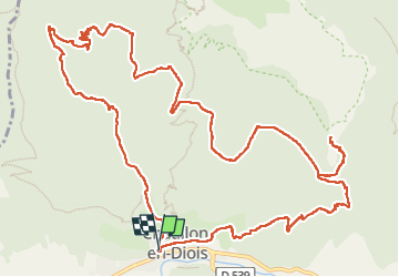

Length
16.8 km

Max alt
1371 m

Uphill gradient
1029 m
Km-Effort
31 km

Min alt
579 m

Downhill gradient
1028 m
Boucle
Yes
Creation date :
2024-12-05 07:56:03.388
Updated on :
2024-12-14 10:16:57.243
7h32
Difficulty : Very difficult

FREE GPS app for hiking
 SityTrail
IGN / Geographical institutes
SityTrail Plus
The world is yours!
About
Trail Walking of 16.8 km to be discovered at Auvergne-Rhône-Alpes, Drôme, Châtillon-en-Diois. This trail is proposed by raygautier.
Positioning
Country:
France
Region :
Auvergne-Rhône-Alpes
Department/Province :
Drôme
Municipality :
Châtillon-en-Diois
Location:
Châtillon-en-Diois
Start:(Dec)
Start:(UTM)
696674 ; 4951987 (31T) N.
Comments