


LES GLIÈRES GUY

Jean-Paulchoux
User
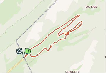

Length
12.2 km

Max alt
1453 m

Uphill gradient
225 m
Km-Effort
15.2 km

Min alt
1364 m

Downhill gradient
225 m
Boucle
Yes
Creation date :
2024-12-15 08:58:15.911
Updated on :
2024-12-15 14:23:42.776
3h22
Difficulty : Medium

FREE GPS app for hiking
 SityTrail
IGN / Geographical institutes
SityTrail Plus
The world is yours!
About
Trail Cross-country skiing of 12.2 km to be discovered at Auvergne-Rhône-Alpes, Upper Savoy, Fillière. This trail is proposed by Jean-Paulchoux.
Positioning
Country:
France
Region :
Auvergne-Rhône-Alpes
Department/Province :
Upper Savoy
Municipality :
Fillière
Location:
Thorens-Glières
Start:(Dec)
Start:(UTM)
293234 ; 5093772 (32T) N.
Comments