


Col Bramont

lorenzot54
User
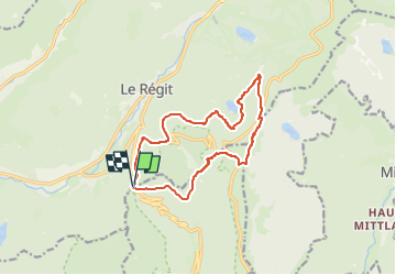

Length
12.6 km

Max alt
1304 m

Uphill gradient
616 m
Km-Effort
21 km

Min alt
928 m

Downhill gradient
620 m
Boucle
Yes
Creation date :
2024-12-27 20:01:20.0
Updated on :
2024-12-27 20:01:22.78

FREE GPS app for hiking
 SityTrail
IGN / Geographical institutes
SityTrail Plus
The world is yours!
About
Trail of 12.6 km to be discovered at Grand Est, Haut-Rhin, Wildenstein. This trail is proposed by lorenzot54.
Description
Col bramont Rainkopf
Positioning
Country:
France
Region :
Grand Est
Department/Province :
Haut-Rhin
Municipality :
Wildenstein
Location:
Unknown
Start:(Dec)
Start:(UTM)
346768 ; 5318377 (32U) N.
Comments
Belle rando entre sous-bois et sommet avec vue magnifique