


001rd parc du château

tine60
User
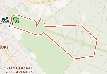

Length
4.8 km

Max alt
66 m

Uphill gradient
41 m
Km-Effort
5.4 km

Min alt
39 m

Downhill gradient
40 m
Boucle
Yes
Creation date :
2025-01-02 13:19:33.563
Updated on :
2025-01-02 14:12:10.336
51m
Difficulty : Easy

FREE GPS app for hiking
 SityTrail
IGN / Geographical institutes
SityTrail Plus
The world is yours!
About
Trail Walking of 4.8 km to be discovered at Hauts-de-France, Oise, Compiègne. This trail is proposed by tine60.
Positioning
Country:
France
Region :
Hauts-de-France
Department/Province :
Oise
Municipality :
Compiègne
Location:
Unknown
Start:(Dec)
Start:(UTM)
487920 ; 5473816 (31U) N.
Comments