


Montée au Goutaroux - 07 juin 2015

morganee
User
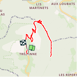

Length
10.7 km

Max alt
1528 m

Uphill gradient
551 m
Km-Effort
18 km

Min alt
1021 m

Downhill gradient
543 m
Boucle
No
Creation date :
2019-07-19 19:06:11.589
Updated on :
2019-07-19 19:06:11.852
3h43
Difficulty : Medium

FREE GPS app for hiking
 SityTrail
IGN / Geographical institutes
SityTrail Plus
The world is yours!
About
Trail Walking of 10.7 km to be discovered at Auvergne-Rhône-Alpes, Isère, Saint-Martin-de-Clelles. This trail is proposed by morganee.
Description
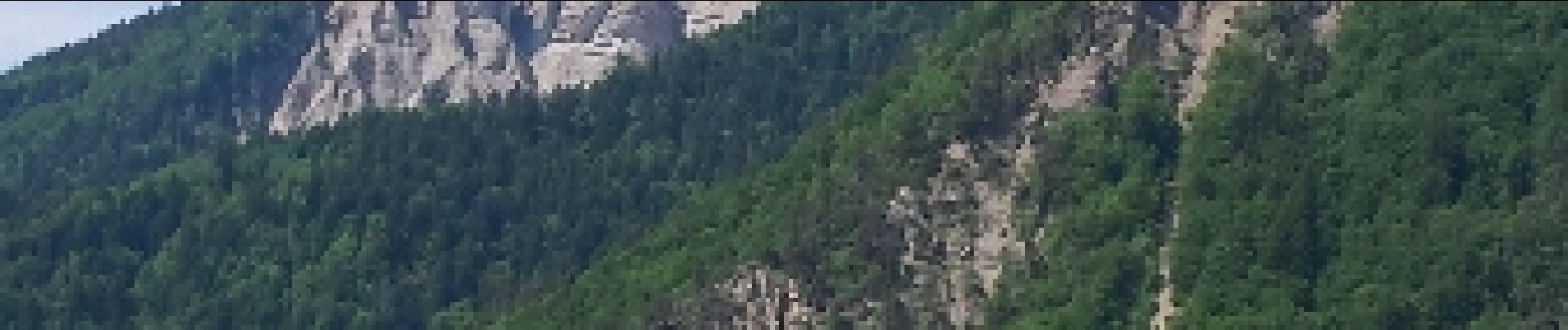
Belles vues sur le Mont Aiguille pendant toute la rando.
Arrivée au sommet du Goutaroux un peu sportive : quelques pas d'escalade pour gravir les 3 derniers mètres.
Photos

Positioning
Country:
France
Region :
Auvergne-Rhône-Alpes
Department/Province :
Isère
Municipality :
Saint-Martin-de-Clelles
Location:
Unknown
Start:(Dec)
Start:(UTM)
703907 ; 4968978 (31T) N.
Comments